 |
| Bound for Carabao Island in Maragondon, Cavite |
Well, in my case, it isn't a forgotten destination but a new discovery.
Edward, a friend I met on the road a year ago, invited me to what he called a historical island hopping in his Cavite hometown. Sure, Maragondon and neighboring towns are blessed with majestic peaks, some of which are beaming with history dating back to the Spanish era. But islands with the same historical importance near Manila? I never knew such, apart from the famed Corregidor Island.
Brief History: Fort Frank is not alone
After the U.S. acquired the Philippines from Spain in 1898, the government, then under the Americans, fortified the islands at the mouth of Manila Bay — forming the so-called "Harbor Defenses of Manila and Subic Bays". Its main purpose is to protect the capital Manila from would-be enemies. This harbor defense unit comprised Fort Frank (the Carabao Island that this post is all about), Fort Drum (or El Fraile Island, often described as a concrete battleship for its remarkable war tank shape), Fort Hughes (Caballo Island), Fort Mills (Corregidor Island) and Fort Wint (or Grande Island, situated in Subic Bay unlike the rest which are in Manila Bay).
READ ALSO: Mt. Pico de Loro, Beyond Her Monolith
Access points to the Philippine islands had to be kept from Japanese forces when World War II broke out. So the Filipino and American forces put the island bastions into use and as history recounts, the command unit headquartered in Corregidor where an eventual battle took place; hence, Corregidor became more popular than the other island fortresses.
Into the Fort's Dark Paths
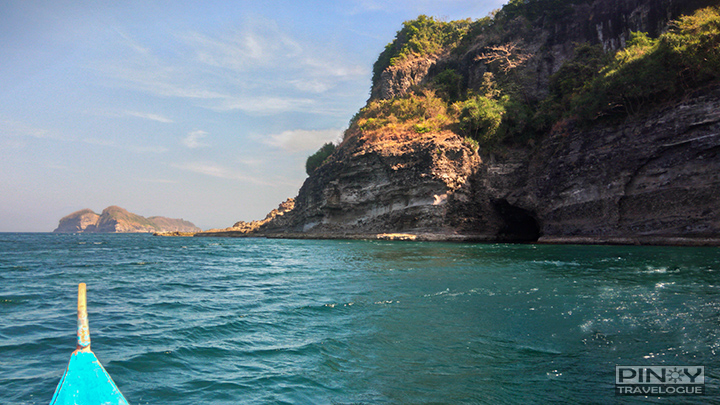
We reached the shores of Brgy. Sta. Mercedes in three hours aboard a comfortable shuttle. It was a fine day. The sun's up and the outrigger canoe that we're about to use barely moves while moored in the gentle shore. But the sea's calmness did not last as we set sail for Carabao Island. Amihan wind cuts through, creating rough repercussions of waves that bumps against our small, narrow vessel. It was a wet and wild ride. But scenic, nonetheless, as we were soaked not just in briny waters but in sight of the island's jagged cliffs.
 |
| Boat docking at the Carabao Island |
With no recognizable docking area in sight, the boat halted amidst the emerald sea that's semi-surrounded by cliffs, some meters away from the shore-less island, to see where we could dock. Then our boatman maneuvered toward a seemingly man-made wall on one corner.
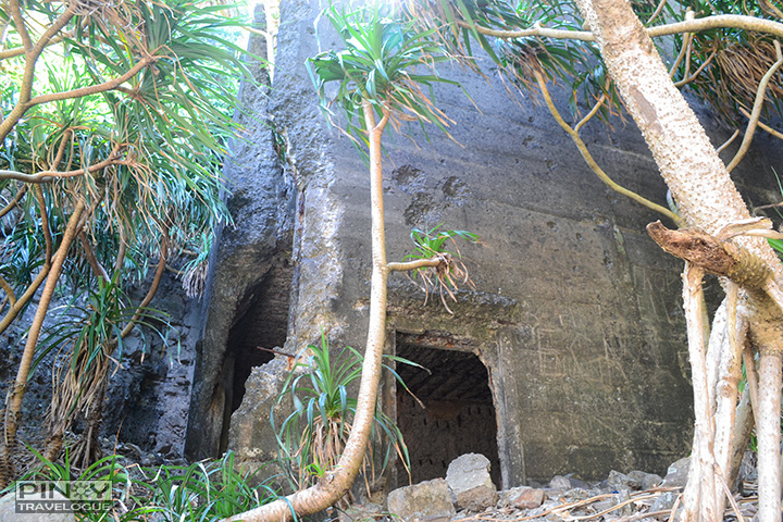
Behind this thick enclosure is Fort Frank's hidden garrison. To get there, we needed to pass through a narrow passageway beneath the concrete slab. It's somewhat back-breaking, it wasn't that easy. One careless movement may lead to a broken head if bumped into concrete or slipped upon the pebbles, and worse, tetanus infection if banged into the wall's protruding iron framework.
 |
| Obstacle-like entrance to Carabao Island's fortress |
 |
| Ruins of a fortress in Carabao Island |
 |
| Stairs leading to the upper portion of the garrison |
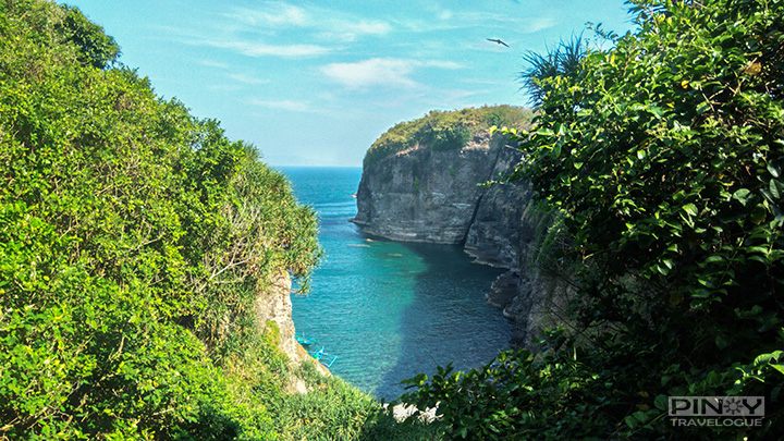
Nature has already reclaimed the barracks of the forgotten island. Upon the successful entry through the giant slab, ruins welcomed us. But it's just a tiny portion of Fort Frank's stronghold. There were flight of stairs that lead to the entirety of the World War II citadel. We went upstairs; but before getting inside the dark hallways, a stunning view of the sea and rugged cliffs dawned.
 |
| Carabao Island's scenic view dawns upon us |
 |
| Carabao Island's scenic view |
The scenic vista is Carabao Island's most powerful draw. It's all worth-it. From the rough tides we braved and the obstacle we had gone through to get at the vantage point, I already felt the trip's highlight. But it couldn't be called a "historical" trip if we wouldn't get into the fort's dark paths. Flashlights on and we roamed around the decrepit military garrison.
 |
| Inside the ruined barracks of Carabao Island |
 |
| Inside the ruined barracks of Carabao Island |
 |
 |
 |
 |
 |
| A deep elevator shaft |
 |
Roaming around the eerie ruins lasted for about an hour. We're supposed to set sail for the next island but our guide insisted that since El Fraile is a concrete island without a shore, it could be dangerous to push through because of the strong afternoon tide. A bit frustrated, we just moved to the nearer but out-of-way Limbones Cove and take our lunch there; then spent the rest of the day at Patungan Beach.
 |
| Patungan Beach with a view of Carabao Island on the far end |
How to Get to Fort Frank, Maragondon
Drive:
- Drive all the way to Brgy. Sta. Mercedes (Patungan) in Maragondon, passing by Kaybiang Tunnel. Upon reaching the shore on the village, rent a boat for the island hopping.
Commute:
- Take a Ternate-bound bus (Saulog or Saint Anthony bus lines) at Coastal Mall or Alabang. Fare: around PHP 80; Travel time: around 2 hours
- In Ternate, you may take a tricycle (special trip) to take you to Brgy Sta. Mercedes. It's quite far and I'm not sure how much it would cost since we went there aboard a private shuttle.
Boat Rental costs around PHP 1200 - 1500; boat size is safe for 5 persons.
TIP: It's best to contact Maragondon Tourism Office to plan your trip; they can prepare everything for you. You may reach them at +63 046 6863139 [Source: Maragondon website].


